Council OKs planning on pathway from downtown to Magee Park By John McLoone PRESCOTT – The Prescott City Council moved ahead with measures toward getting significant trail projects ou the ground at …
This item is available in full to subscribers.
To continue reading, you will need to either log in, using the login form, below, or purchase a new subscription.
If you are a current print subscriber, you can set up a free website account and connect your subscription to it by clicking here.
Otherwise, click here to view your options for subscribing.
Please log in to continue |
Council OKs planning on pathway from downtown to Magee Park
By John McLoone
PRESCOTT – The Prescott City Council moved ahead with measures toward getting significant trail projects ou the ground at its meeting Monday, April 25.
The council first gave its unanimous ap –
proval to a resolution of support for the Cou – lee River Trails project and acquisition of the Pine Coulee portion of the trail by the Menomonie-based Landmark Conservancy.
The Town of Oak Grove passed a similar resolution at its April 19 meeting.
Both government bodies were asked to pass the resolutions as the Landmark Conser – vancy plans to apply for funding through the Wisconsin Department of Natural Resourc – es' Knowles-Nelson Stewardship Program to purchase the Pine Coulee tract, owned by Kim Christianson, that is located in both the city and township.
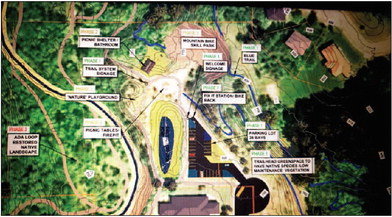
The Coulee River Trail system would have initial phases starting at an expanded Magee Park in Prescott. It would head up Highway 35 to Freedom Park before meandering to the 80-acre Pine Coulee property. Plans for the overall trail system include three under-High –
way 35 crossings and pathways along south –
ern Prescott that border Prescott School dis – trict property.
The Pine Coulee property is seen as the centerpiece of the system. The site borders the Mississippi River. The purchase by the Landmark Conservancy would guarantee a lifetime of public use of the land.
Alderperson Maureen Otwell said that at
See MAGEE PARK, Page 13 Magee Park
Page 1
some point she'd like to see clarification on who exactly is overseeing the Coulee River Trails project.
“I want to bring up something that is concerning me a little bit about the Coulee River Trail Project. I’m not sure the overall entity that’s in charge of the project. I think that needs to be clarified," she said. "The Friends of Freedom Park are a little bit reluctant to take it on, and the city hasn't ovcially said it’s our project. I think we need a little bit of clarification about who the legal entity is in this project. Who’s going to administer the grant funding? Are the Friends going to administer that or is the city going to administer the grant? Because, if it’s a federal grant, there’s a lot of work that goes into overseeing those type of federal grants. I just want us to get a little bit more clarity in that area. And I’m not asking for that tonight. I think this is still in the concept phase, so we can pass the resolution without that being clarified." The city council also gave the go-ahead to Cedar Corp., its engineering firm, for grant writing and preliminary engineering work for a Scenic Byways Grant through the Wisconsin Department of Transportation to help pay for trail work from downtown to Freedom Park, along Monroe Street to Washington Street and into Magee Park. The contract with Cedar Corp. is for $4,000 to write the grant and up to $5,000 for engineering work.
As part of the motion, city stau and Ce dar Corp. must meet with the Lubich family, which owns property that the trail would cross to get to the adjacent Magee Park, to find a route that they would be agreeable to. The Scenic Byways Grant is through the Federal Highway Administration and is administered in the state through the DOT. City Administrator Matt Wolf said that development of Freedom Park was done through a Scenic Byways Grant.
Seth Hudson of Cedar Corp. told the council that the DOT is warm to the city prospects in getting the grant, which would need a 20% match in local funding. Initial proposals are for the path to go from Monroe Street to Washington Street “and then through a right of way that the city already has to get to the back of Magee Park." There's one ravine where a pedestrian bridge would need to be built.
“This program is designed to connect stops along the Scenic Highway, so Magee Park is one of those stops. Freedom Park is one of those stops and with connecting them, WisDOT really liked the project and has been supporting us," said Hudson.
The project would be done in two phases:
Downtown to Freedom Park and then from Freedom Park to Magee Park.
Hudson estimated "at a high level" the overall project cost would be about $1.5 mil lion.
The city easement to Magee is across the Lubich property on a platted street that was never developed. The Lubichs have concerns about people on their property, and the initial plan is for the trail to be within 20 feet of a home.
"Coming in and forcing a trail within 20 feet of their mother’s house is, in my opin- ion, a little heavy-handed," said alderperson Thomas Oss. “I’d like to see if the Lubichs are amenable to a negotiated movement of the path. The city should explore that." Hudson answered, “The map that we showed is just a proposed layout. Nothing is set in stone yet." “Ultimately, it’s for the council to decide exactly where you’d like to put that, but this was just for discussion purposes, to show roughly that as a place to connect," said Hud son. “Of course, we went the easiest path, which was along right-of-ways, but I totally understand you don’t want a path right in front of someone's front door." Wolf explained that the city would have the right to use the easement.
“It’s just like when we do a sidewalk. We don’t go to the property owners and say, ‘We’re going to do a sidewalk. Are you OK with that?’ We propose sidewalks. We put in the sidewalk. We come to them and say this is the plan we’re doing. That’s the idea behind this as well," Wolf said. "I don't think we've ever negotiated for a sidewalk in the past. Obviously, that’s something well within the council’s right if we want to start doing nego- tiations within right of way, we can do that." Jim Lubich said they don’t have a problem with the trail concept, just the location.
“It’s right next to the house, and we have a field there. People are going to want to come play. That’s private property. It’s been forever. I don’t think anyone else would want people in their yard all day playing," he said. “We’re just trying to work with everybody here." He suggested a path from Monroe to Laura Street and then to Magee Park as a solution.
“That would just be a block father to the north, and then shoot right down there and angle toward the ravine wherever you want to cross," he said.
Council members agreed that there are options to make the plan work.
“I think there are alternatives that wouldn’t make it any longer or shorter to get there," said Otwell. “The idea of the trail is for people to walk or ride bikes along those things, so I don’t think anybody will care where we put it to connect the two parks. I think this is totally negotiable."