Great Rivers Subdivision future phases would be impacted by planned north-south connector route By John McLoone PRESCOTT – Plans may change for a future north-south bypass of the City of Prescott. …
This item is available in full to subscribers.
To continue reading, you will need to either log in, using the login form, below, or purchase a new subscription.
If you are a current print subscriber, you can set up a free website account and connect your subscription to it by clicking here.
Otherwise, click here to view your options for subscribing.
Please log in to continue |
Great Rivers Subdivision future phases would be impacted by planned north-south connector route
By John McLoone
PRESCOTT – Plans may change for a future north-south bypass of the City of Prescott.
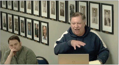
The Prescott Plan Commission last Monday asked for more information on options and prices for developing the corridor, which is included in the city’s comprehensive plan to be built in the future. Developers of the Great Rivers Subdivision raised concern that the location of the road could impact the number of homes they can build.
The Most Family Partnership is seeking to develop its third phase of 49 homes. The total development is planned in six phases, totaling 300 homes. Lynn Most explained to the plan commissioners the benefit for the community and Prescott School District with the number of new families moving into new homes in the Great Rivers Subdivision.
See GREAT RIVERS, Page 11 Great Rivers
from Page 1
City Administrator Matt Wolf said that the planned route to bypass the congested downtown runs from Highway 29 across Highway 10 and connects to Hollister Avenue on its way south to Highway 35. The Great Rivers Subdivision current phase is north of Hollister. A four-lane road with limited access points off of it would limit the number of homes that could be developed in future phases.
Most suggested that 1200th Street, which already runs from Highway 10 to Highway 35 and connects to Hollister (570th Street), should be expanded as the alternate route.
Wolf presented three options to planners: Keep the corridor as it is mapped in the 2015 comprehensive plan.
Downgrade the arterial road to a two-lane collector road, which would allow for driveways along what is now Sea Wing Boulevard off of Hollister.
The first two options would require the city to build a bridge over a ravine to the north of the Most property at an expense of at least $7 million.
Not build a north-south connector road. Wolf noted that the road project is not in Wisconsin DOT plans for the next seven years.
Plan commission members had varying viewpoints, and Mayor Rob Daugherty said the matter will have to return to the body when cost alternatives are available.
“There’s been a lot of discussion on this,” said Daugherty. “I’m not going one way or the other.”
He did point out that in consideration of 1200th Street, “The street’s already there. 1200th Could be improved and so could Hollister,” he said.
Building 1200th to handle more vehicles would require Town of Oak Grove cooperation, since the road is in the township.
“We would recommend the 1200th Street option. As everyone knows, it’s getting more developed out there. There’s a lot of homes out there,” said Most.
He projected that expanding 1200th Street would cost $1.5-$2 million, and he predicted that an option that would include building the bridge over the ravine would be in the neighborhood of $18 million. He said that much of the truck traffic already bypasses Prescott by using County Road E between highways 10 and 35.
Allowing for as many homes in future phases in the Great Rivers Subdivision is good for the overall community, said Most. He said that the first two phases each have about 75-100 school-age children residing there, which means a lot of state aid for Prescott Schools.
“They’re getting a little over $10,000 per kid. That’s a $1.9 million for each phase. That totals a little more than $6 million in one year back to the school if we developer these 300 homes,” said Most. “That’s a lot of money.”
“If you jeopardize our development and run (the connector through it), everyone loses,” he said.
Most pointed out that the city has extraterritorial rights to have 1200th Street expanded.
“Lynn’s point is correct,” said Wolf, “but in our comprehensive plan, we haven’t done that. We do have the ability to work on that process, but right now, it’s not in our comprehensive plan.” He said the comprehensive plan would need to be amended if the connector road was downgraded to two lanes or if 1200th Street was chosen as an alternative.
Daugherty referred the matter to staff to try to get present-day figures on how much the bridge would cost.
“It kind of sounds like we need to bring this back,” he said. “This has been a good discussion.”planned route to bypass the congested downtown runs from Highway 29 across Highway 10 and connects to Hollister Avenue on its way south to Highway 35. The Great Rivers Subdivision current phase is north of Hollister. A four-lane road with limited access points off of it would limit the number of homes that could be developed in future phases.
Most suggested that 1200th Street, which already runs from Highway 10 to Highway 35 and connects to Hollister (570th Street), should be expanded as the alternate route.
Wolf presented three options to planners:
• Keep the corridor as it is mapped in the 2015 comprehensive plan.
• Downgrade the arterial road to a two-lane collector road, which would allow for driveways along what is now Sea Wing Boulevard off of Hollister. The first two options would require the city to build a bridge over a ravine to the north of the Most property at an expense of at least $7 million.
• Not build a north-south connector road.
Wolf noted that the road project is not in Wisconsin DOT plans for the next seven years.
Plan commission members had varying viewpoints, and Mayor Rob Daugherty said the matter will have to return to the body when cost alternatives are available.
“There’s been a lot of discussion on this,” said Daugherty. “I’m not going one way or the other.”
He did point out that in consideration of 1200th Street, “The street’s already there. 1200th could be improved and so could Hollister,” he said.
Building 1200th to handle more vehicles would require Town of Oak Grove cooperation, since the road is in the township.
“We would recommend the 1200th Street option. As everyone knows, it’s getting more developed out there. There’s a lot of homes out there,” said Most.
He projected that expanding 1200th Street would cost $1.5-$2 million; he predicted that an option that would include building the bridge over the ravine would be in the neighborhood of $18 million. He said that much of the truck traffic already bypasses Prescott by using County Road between highways 10 and 35.
Allowing for as many homes in future phases in the Great Rivers Subdivision is good for the overall community, said Most. He said that the first two phases each have about 75-100 school-age children residing there, which means a lot of state aid for Prescott schools.
“They’re getting a little over $10,000 per kid. That’s $1.9 million for each phase. That totals a little more than $6 million in one year back to the school if we develop these 300 homes,” said Most. “That’s a lot of money.
“If you jeopardize our development and run (the connector through it), everyone loses,” he said.
Most pointed out that the city has extraterritorial rights to have 1200th Street expanded.
“Lynn’s point is correct,” said Wolf, “but in our comprehensive plan, we haven’t done that. We do have the ability to work on that process, but right now, it’s not in our comprehensive plan.” He said the comprehensive plan would need to be amended if the connector road was downgraded to two lanes or if 1200th Street was chosen as an alternative.
Daugherty referred the matter to staff to try to get present-day figures on how much the bridge would cost.
“It kind of sounds like we need to bring this back,” he said. “This has been a good discussion.”